What East Africa Map Quiz measures
This quiz does not certify you for border surveying, foreign service hiring, academic geography degrees, or travel influencer authority. It measures how much you agree with statements in four groups: regional chunks about learning Great Lakes, Horn, and landlocked neighbors in layers instead of one continent cram; coast and interior about Indian Ocean shores, landlocked states, Great Rift highlands, and western rift lakes; blank map practice about outline tracing, spaced retakes, landmark pairing, and kind sharing without classmate insults; and cultural respect about accurate place names, avoiding single-story stereotypes, diverse sources, and fun curiosity separate from civilization scoreboards. You rate 22 statements from strongly disagree to strongly agree, with reverse-worded items so autopilot responding cannot inflate every bar. Your answers also feed a second chart on closeness and trust habits, because map confidence fandom sometimes chases certainty over patient study humility. The total becomes an index from 0 to 100 where higher means more endorsed East Africa map study statements on this screener, not proof you must debate borders online or skip respectful reading.
Regional chunks
Great Lakes trios, Horn neighbors, landlocked pairs, and South Sudan on modern lists without one-night continent cram.
Coast and interior
Indian Ocean coasts, rift highlands, savanna interior stories, and Tanganyika or Malawi lake zones.
Blank map practice
Outline self-checks, tablet tracing, spaced retakes, landmark pairing, and fun shares without insults.
Cultural respect
Careful spellings, anti-stereotype habits, diverse sources, and quizzes as curiosity not ranking.
How it works
Answer 22 agreement items
Rate each statement from Strongly disagree to Strongly agree. Tap Next after each answer.
Answers sort into four domains
Each answer feeds one of four East Africa map study groups, and every item also feeds a closeness and trust layer.
See your index and charts
You get a 0 to 100 index, a band, and two bar charts you can compare with a friend studying AP human geography or travel trivia.
Take the East Africa Map Quiz
Answer 22 short statements to see your East Africa map study confidence index, four domain bars, and a closeness and trust chart.
What your result means
Your index is the average of all 22 answers, scaled from 0 to 100, with reverse-worded items flipped first. Read cultural respect before celebrating a high coast-interior or blank map bar. Geography study is for real classrooms and kind curiosity; atlas humility beats lecturing people who share different study timelines.
| Band | Index range | Typical reading |
|---|---|---|
| Building East Africa map confidence | 0 to 35 | Fewer agreed study habits or regional literacy items on chunks, coast-interior, practice, or respect lanes. |
| Mixed East Africa map confidence | 36 to 65 | Solid habits in some domains with coast-only myths or weak blank map routines in others. |
| Stronger East Africa map confidence | 66 to 100 | Frequent agreement across chunks, coast-interior literacy, blank map practice, and respect habits; still fun only. |
Tips at a glance
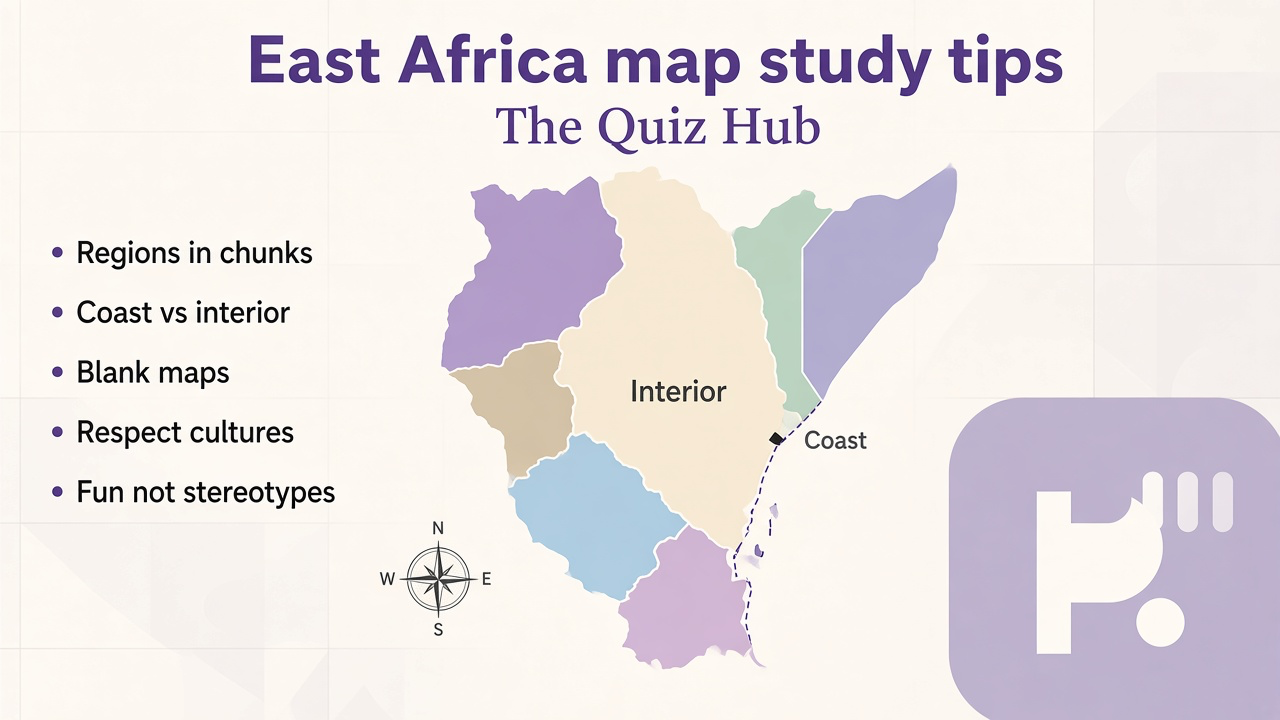
A quick takeaway graphic with topic tips (not your personal quiz scores). Start the quiz for your index, bands, and charts.
What this quiz can and cannot tell you
Can tell you
- Show which East Africa study habit cluster your self-report resembles this month
- Spark a fun map chat with friends who want chunks and outline practice, not border flame wars
- Highlight when enthusiasm might need more cultural respect or more blank map tracing time
- Offer a baseline if you retake after one focused geography unit or summer atlas project
Cannot tell you
- Certify embassy hiring, survey licensure, or official border arbitration credentials
- Prove you know every disputed boundary or local name variant better than residents and scholars
- Replace geography teachers, AP exam prep, or university cartography courses
- Turn scores into harassment, stereotype jokes, or fake diplomat badges online
East Africa map study as chunks, coastlines, and respectful curiosity
Search traffic around East Africa map quizzes usually wants two things: remember which countries touch the Indian Ocean and share scores without sitting through a three-hour political lecture. Those goals help when readers notice that map screeners track study habits and regional literacy together, not courtroom verdicts on nations. They hurt when people treat bars like proof someone is ignorant, or when comment threads mock spellings of cities they never looked up.
Dr. Rachel Kim reviews fun novelty geography quizzes with a simple split: reward honest reflection on study method and honest respect limits at the same time. Regional chunks tracks Great Lakes trios, Horn neighbors, and landlocked pairs without pretending every textbook uses identical country lists. Coast and interior tracks ocean shores, rift highlands, savanna interior stories, and western rift lakes without moralizing every travel photo a student reposts. Blank map practice tracks outline tracing, retakes, and kind shares without demanding perfect border artistry on day one. Cultural respect keeps name care, anti-stereotype framing, and diverse sources visible beside viral listicles that rank civilizations for clicks.
Real readers mix bars. You might score high on blank map practice while keeping regional chunks moderate, which often describes students who trace well yet still merge Horn and Great Lakes lists. You might score high on coast-interior with moderate respect bars, which can mean strong rift lake recall while pop culture still supplies single-story nation jokes. Reverse items catch sloppy answers: insisting alphabetical capitals are the only path, claiming East Africa has no interior highlands, treating fun scores like embassy hiring, or trusting adventure TV without textbooks should not inflate bars meant to track layered study stories.
Pair results with siblings on this hub instead of forcing one East Africa story. Our central Africa map quiz leans Congo basin and landlocked recall without repeating your Indian Ocean checklist. The Africa map quiz stays continent-wide when you want big picture before regional depth. Browse the fun and novelty hub for more light screeners. Caption shares as fun study reflection and skip border policing strangers who never asked for a geography sermon.
Semesters change faster than trending travel reels. East Africa units arrive once a year in many schools, but respectful reading and outline maps stay useful all year. When you share results, say chunks and practice count. When you borrow map tips, credit teachers and African journalists who explain place names carefully. Retake after one focused month and watch whether respect bars rise even if chunk bars lag, which often means you separated real study humility from performative map scoring online.
| Test | Focus |
|---|---|
| Central Africa map quiz | Congo basin and central landlocked recall rather than Indian Ocean and Great Lakes chunk lanes |
| Africa map quiz | Continent-wide placement rather than East Africa coast-interior depth |
East Africa Map Quiz FAQ
What does East Africa Map Quiz measure?
It measures how much you agree with statements about regional chunks, coast versus interior cues, blank map practice, and respectful cultural curiosity. You get an index from 0 to 100 plus four bars. It describes self-rated study habits on this screener, not embassy hiring, border certification, or moral ranking of cultures.
Which countries count as East Africa on this quiz?
Items follow common classroom groupings such as Great Lakes states, Horn neighbors, Indian Ocean coasts, and modern lists that include South Sudan. Atlases disagree on edge cases; treat bars as study hints and confirm details with your teacher or atlas legend.
Does a high score mean I should debate borders online?
No. High bars mean you related to study and literacy statements here. Respectful sources and local voices matter more than trivia scores. Cultural respect items explicitly reject civilization ranking and stereotype jokes.
Why mix blank map practice with cultural respect items?
East Africa search intent blends where countries sit with how learners talk about them. Split bars keep outline tracing wins separate from name care and anti-stereotype habits so results stay honest about which parts you endorse.
Who reviewed this quiz?
Dr. Rachel Kim reviewed the fun-only framing, respect limits, and playful geography tone. See our editorial policy for review standards.
Reviewed by